Preserving & Promoting
Local History, Art, & Culture


Results found for ""
- Historical Maps 1876
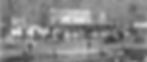
< Previous > Back to Historical Map List < Next > 1876 - Fairmount Park Int'l Exhibit Source: URL: Free Library of Philadelphia https://libwww.freelibrary.org/digital/item/52583 Full Name: Fairmount Park International Exhibition: Philadelphia, 1876, Map Visit the source URL to use zoom features, find additional formats, or download a high quality image.
- Leverington Cemetery
Leverington Cemetery Lyceum Ave & Ridge Ave, Philadelphia, PA 19128, USA Owner: Leverington Cemetery LLC Status: This is a historic cemetery that is still accepting new residents. Visitors are welcome during daylight hours when the front gate is open. Please watch your step -- old graveyards tend to have uneven ground and more than a few groundhog holes. History In 1703, Elizabeth, the 13-year-old daughter of Wigard Levering, was the first to be laid to rest on this land. Dozens of other Leverings would eventually join her as would their descendants, neighbors, and thousands of residents not only from the 21st Ward, but from across Philadelphia and Montgomery County. In the 320 years since Elizabeth's death, the cemetery was known as the Roxborough Burial Grounds and eventually the Leverington Cemetery -- taking its name from the area named in deference for the founding Levering families in the area. Memorials Revolutionary Soldiers Memorial Civil War Soldier Memorial Map A map of cemetery has been provided below. Burial Records & Resources Burial records & resources are available through Ancestry.com , FamilySearch.com , and Findagrave.com . If those resources do not provide the information you are looking for, you can contact RMWHS . Please note, you should check the online resources first as a courtesy to our volunteer archivists. Volunteers Welcome Each Spring members of the community are invited to participate in Clean-up & Planting Day. Volunteers and local groups come spend a few hours one Saturday doing minor weeding and landscaping projects as well as tending to the planters and cradle beds. If you are interested in helping, join/watch the Friends of Leverington Cemetery on Facebook for details on the date (which is typically in mid-to-late April). Adopt a Cradle Grave If you are interested in adopting a cradle grave, contact RMWHS . A few of our members organize weeding, planting, and occasional watering of a number of the cradle graves throughout the cemetery. We appreciate your assistance in help in beautifying one of our most treasured landmarks. Gallery of Photos Map
- RMWHS | MSMHD | Main Street Manayunk
Main Street Manayunk Historic District Main Street Manayunk Although the industrial areas of Venice Island were substantially developed by the 1870s, Main Street did not reach the peak of its development as a commercial and retail center until the early 20th century. In the mid-19th century, Main Street served as the principal land route for the transportation of people and goods in and out of Manayunk. It initially developed as a residential street and business center, responding to the industrial growth of Venice Island. In 1850, the Girard College and Manayunk horse drawn streetcar line operating on Main Street was completed linking Manayunk to the city via Ridge Avenue. At this time, the south side of Main Street was largely open to the canal. Bridges at cross streets connected Main Street to Venice Island. The north side of Main Street was almost fully developed between Pensdale and Carson with residential development on side streets north of Main Street extended as far up as Silverwood Street. Describe your image Through the 1870s, industrial development on Venice Island continued and the business center grew as commercial development spread along the south side of Main Street between Lock and Grape Streets. Much of this growth came in the form of mill offices. With the increasing importance of Main Street as a business center, hotels developed on the north side of Main Street, near the railroad station, and also banks, such as the Manayunk National Bank at Levering and Main. By 1890, development of the south side of Main Street extended west to the 4300 block of Main Street, including the Manayunk Trust Co., at 4336 Main Street. By the close of the century Main Street had become the commerce and institutional center for Manayunk. Describe your image Main Street in the early 1900s remained a business and commerce center tied to Venice Island industry rather than a retail shopping district. By the 1920s, the south side of Main Street was fully developed, breaking any visual link between the commercial district and the canal industrial zone. However, as suburban residential growth occurred in Roxborough the character of Main Street shifted to retail shopping and entertainment catering to local trade. The Empress Theater was constructed on the site of the last remaining hotel on Main Street at 4439, and department stores such as the Foster Department Store at number 4268 and Propper Brothers at Levering Street north of Main Street. Describe your image The Depression years brought the closing of many mills in Manayunk and the decline of Main Street as a community retail center. New retail activity concentrated first on the strip shopping district along Ridge Avenue, and then in the freestanding shopping centers, further west on Ridge Avenue. After a long period of decline evidenced by many vacant stores, there is renewed interest in the commercial strip, as antique shops, and restaurants, seeking out low rent locations, have established businesses on Main Street. Recently, one of the larger structures on Main Street has been renovated for professional office use. This information has been posted by RMWHS with the permission of the Philadelphia Historical Commission. Sections: 1 Intro and Nomination Form 2 Description 3 Significance of Manayunk 4 The Schuylkill Canal 5 Schuylkill Navigation Company 6 Manayunk Canal 7 Economic Development 8 Manayunk Social Development 9 The Industry of Venice Island 10 Main Street Manayunk 11 Bibliography 12 Boundary Details 13 Map Top of page
- RMWHS | RARHD | Federal Architecture
Ridge Ave Roxborough Historic District Federal Architecture The Federal style of architecture, which emerged after the Revolutionary War, is closely related to the earlier Georgian or Colonial style, but Federal buildings are lighter and more delicate than their predecessors, which were generally weighty with stout detailing. Like the earlier houses, Federal houses are generally side-gabled, two-story, symmetrical boxes. Wissahickon schist remained the predominant building material, but the stone was sometimes faced with stucco. The Federal style was employed in Roxborough Township from the 1780s through the 1820s. The Levering-Jones House at 6341 Ridge Avenue, which also served for a short time as the General Washington Tavern, is an excellent example of the Federal style (Figure 20). Built about 1796 by William and Martha Levering, the house was converted to a tavern in the early nineteenth century. It was later converted back to a residence and was the boyhood home of prominent historian Horatio Gates Jones Jr. The house was restored to its original appearance in the twentieth century. Its side-gable, symmetrical façade, pedimented door surround, and pedimented dormers with Gothic windows are all hallmarks of the Federal style. The Starne-Smick House at 7552 Ridge Avenue, built about 1795, is another good example of a Federal style house in Roxborough. Although without the high-style embellishments of the Levering-Jones House, the Starne-Smick is a large, well-preserved, significant example of the style. The Joseph Ozias House of 1811 at 7953 Ridge Avenue is another example of a well-preserved Federal style house. The cut-stone front façade with quoins at the corners is an interesting feature of this otherwise modest residence. Describe your image This information has been posted by RMWHS with the permission of the Philadelphia Historical Commission. Sections: 1 Intro and Nomination Form 2 Boundary and Description 3 Statement of Significance 4 Native Americans 5 Patent Holders and Early Settlers 6 Ridge Road 7 Early Roxborough 8 Georgian and Colonial Architecture 9 During the Revolutionary War 10 Federal Architecture 11 Development of Manayunk 12 Greek Revival Architecture 13 Early 19th Century 14 Gothic Revival Architecture 15 Italianate Architecture 16 During and After the Civil War 17 Second Empire Architecture 18 Queen Anne Architecture 19 Turn of the Century 20 Conclusion and Bibliography Top of page
- RMWHS | MSMHD | Description
Main Street Manayunk Historic District Description The Main Street Manayunk National Historic District is located on the north bank of the Schuylkill River, approximately 5 miles northwest from the center of Philadelphia. The community of Manayunk has retained a strong individual physical identity. Geographically, Manayunk and the adjacent communities of Roxborough and Wissahickon are separated from other sections of Philadelphia to the east, by the steep ravine of the Wissahickon Valley. Main Street is located within the narrow flood plain of the Schuylkill. North of Main Street, the topography rises steeply to Ridge Avenue on the crest between the Schuylkill and Wissahickon. Because of the geographical and cultural isolation of Manayunk, the physical appearance of the townscape and individual buildings differs markedly from those of similar eras built in other sections of the City. While Philadelphia residential and commercial buildings are typically red brick, those of Manayunk are commonly constructed of random coursed stone, Wissahickon Schist, either exposed or faced with stucco. It is the combination of steep topography, and white painted, pitched roof, stucco row houses which epitomizes the physical character of Manayunk. Describe your image The clear hierarchy of land use developed in Manayunk followed construction of the canal. The principal mill buildings were located on Venice Island between the Schuylkill River and Canal, though many of the major mills had operations on both sides of the canal, linked by bridges; often mill offices were located on the south side of Main Street. In contrast, commercial uses -- such as offices, hotels and banks, and mixed residential/ commercial buildings tended to concentrate on the north side of Main Street. Residential construction, typically in the form of attached 2- or 3-story row houses occurred on the side streets off the north side of Main Street. While the earliest development consisted of mill buildings and worker housing, later 19th century development included a broader range of commercial uses, including banks, warehouses, and retail stores, particularly at the west end of Main Street, corresponding to Main Street's developing role as a full retail and business center. Little development or redevelopment occurred in Manayunk after the turn of the century, and the overall physical appearance of the Main Street historic district has changed little since this time, although many retail and business uses have been replaced with lower grade warehouses, and storage uses. The earliest buildings remaining in Manayunk are mills of the 1840s and 1850s, and worker housing of the same era. Several of these mills remain on the Main Street side of the canal, at the east end of Main Street. The finest remaining mill building within the historic district is that located at 4268-72 Main Street, originally known the Blantyre mill. The two, 3-story pitched roof buildings, set at right angles to Main Street were constructed in 1847, of random stone rubble, with cut stone quoins, and brick arches over the window openings. An unusual feature are the fanlights in the gable ends facing Main Street. Describe your image Other important early mills include a 2-story building at 4050 Main Street, constructed about 1850 (originally the Roxborough Mills), a 4-story building at 4100 Main Street (formerly the Dexter Mills - dyeworks) and the rear buildings are facing the canal at 4208 Main Street (formerly Economy Mills). These buildings are typically long, narrow span structures of random stone rubble, often with a later stucco facing, and shallow pitch roofs. Window openings commonly have brick arch lintels, while windows are typically wood, arched head double hung with 4/4 or 12/12 lights. Another noteworthy loft building located on the north side of Main Street at 4313 in a 3-story, 6-bay structure built in 1859 of Wissahickon Schist. The building has segmentally arched brick labels over each window, and wood double hung windows. Describe your image Examples of housing of this era remain, both on Main Street, and on the narrow side streets. The housing is utilitarian, working class attached housing, Vernacular in style, although exhibiting distinct characteristics of formal design styles. The earliest housing is typically constructed in a Vernacular Federal style, while later housing is of a Vernacular Italianate style. The earliest remaining residential buildings are located at 104-106 Levering Street, constructed about 1840. These are 3-story, 2-bay, Federal style, stucco over stone rubble, pitched roof structures. The 2nd floor windows are double hung wood with plan frame, and the 3rd floor windows are casements. 103-105 Pensdale Street is a group of small Vernacular style worker houses built circa 1860. Built of stone rubble faced with stucco they have double hung 2/2 arched head windows and decorative wooden cornices. In contrast to the early simple random stone and stucco mills, later commercial buildings are commonly of brick, exhibiting the richer detailing typical of the late Victorian era, and are similar to such buildings in Philadelphia Some of these later buildings were manufacturing facilities, but many reflected the increasing importance of Main Street as a business and retail center. The finest example of a later industrial building is 4236 Main Street, an elegant 3-story, 3- bay brick loft constructed about 1890. The 1st-floor storefront incorporates a cornice, and central entrance flanked by pilasters. Crowning the building is a heavy wood cornice. 4346 Main Street is the former Manayunk Trust Company building, a monumentally scaled, single story banking hall, built in 1890. Constructed of brick, the building has pilasters with decorative capitals and consoles, stone cornices, and monumental scale windows with a stone surround enhanced with Greek key design. 4360 Main Street is a heavy 3-story, 5-bay brick warehouse constructed about 1890. The Romanesque detailing includes paired semi-circular headed windows on the 3rd floor, Palladian style 2nd floor windows, brick pilasters and a molded tin cornice. A similar style 2-bay, 4-story Romanesque style brick warehouse is located on 108-12 Levering Street. Noteworthy retail buildings include 4356 Main Street, an elegant 2-story building of 1880, featuring extensive use of glass. The ground floor consists of large storefront windows and recessed entrance way, with decorative metal transom panels above. The 2nd floor has large, fixed sash with transom lights, metal faced dividing mullions, and molded metal cornice. Describe your image Finally, there are some interesting turn of the century commercial buildings. 4437 Main Street is a handsome single story brick bar built in 1903. The facade incorporates a decorative ogee arch stepped brick gable parapet, with metal trim. 4323-24 Main Street, the Nickles Building of similar date, is a 2-story, 2-bay brick retail store with elegant, curved glass display windows, and a large ornate metal cornice and parapet. Describe your image This information has been posted by RMWHS with the permission of the Philadelphia Historical Commission. Sections: 1 Intro and Nomination Form 2 Description 3 Significance of Manayunk 4 The Schuylkill Canal 5 Schuylkill Navigation Company 6 Manayunk Canal 7 Economic Development 8 Manayunk Social Development 9 The Industry of Venice Island 10 Main Street Manayunk 11 Bibliography 12 Boundary Details 13 Map Top of page
- RMWHS | RARHD | Gothic Revival Architecture
Ridge Ave Roxborough Historic District Gothic Revival Architecture The picturesque Gothic Revival style was popularized by landscape architect Andrew Jackson Downing’s Cottage Residences, first published in 1842 and reprinted in many editions in the mid and late nineteenth century. In the eighteenth and early nineteenth centuries, American architecture styles, including Georgian, Adam, Federal, and Greek Revival, were predicated on Classical forms and vocabulary. In the early nineteenth century, as industry grew, rural areas transitioned into suburbs, a middle class emerged, and the field of architecture was professionalized in the United States. Those architects proposed a new architectural vocabulary appropriate for housing in suburban environments. In 1837, architect Andrew Jackson Davis (1803-92) published Rural Residences, in which he drew from British sources to champion the Gothic Revival style for domestic architecture for the first time in America. Rural Residences was influential, but the Gothic Revival style for American domestic architecture was catapulted into collective national consciousness by landscape architect Andrew Jackson Downing (1815-52), a friend and collaborator with Davis, who published A Treatise of the Theory and Practice of Landscape Gardening (1841), followed by Cottage Residences (1842), and The Architecture of Country Houses (1850). In his books, Downing popularized the modest-sized, inexpensive detached cottage in a suburban or rural setting. Downing’s pattern books provided multiple design suggestions for this type of dwelling, ranging from a small suburban cottage to a villa in the Italian style. By the mid-1840s, the picturesque Gothic or Gothic Revival style of architecture began to increase in popularity for residences, largely due to Downing’s pattern books. Downing’s Cottage Residences is considered “one of the most widely used books in American architectural literature.”80 Downing’s The Architecture of Country Houses, a companion to Cottage Residences, has been called a “seminal” book in American architecture. According to the National Historic Landmark nomination for the Rotch House, a Gothic Revival house in New Bedford, Massachusetts designed by Davis in 1845, “the publication and eventual dissemination and popularity of Downing’s Country Houses became a watershed event in the evolution of American domestic architecture, and today cultural historians recognize the book’s significant consequences for the shaping of popular taste in the pre-Civil War period.”81 While his books included many details of house and landscape designs, Downing provided the designs as suggestions, which a builder could adapt to the site and the needs of the homeowner. Downing’s books, in collaboration with Davis, who provided many of the architectural designs and illustrations, inspired the design of numerous cottage residences in rural and suburban settings, leading to an era characterized by these types of Victorian cottage residences. A rural, rather than urban, setting was considered important to the Gothic Revival style, as the building was intended to be compatible with the natural landscape, not situated on a narrow urban lot.82 The primary distinguishing characteristic of the Gothic Revival style is the centered cross gable roof with decorated barge boards. Other characteristics include finials, steeply pitched roofs, pointed arch lancet windows extending into the gables, and open entry and full-width porches with flattened, pointed Gothic arches. One of the best examples of the Gothic Revival style in Roxborough is the Amos Barnes House at 559 Righter Street, at the intersection of Ridge, Righter, and Hermit. Constructed of Wissahickon schist about 1856, the Barnes House effectively represents the Gothic Revival style with Victorian Cottage elements, as reflected in the center cross gable decorative barge board at the roofline. Originally, the building had a full-width front porch and lancet window at the gable (Figure 29). Other excellent examples of the Gothic Revival style on Ridge Avenue include the houses at 5508 Ridge Avenue, which includes the centered cross gable, arched gable windows, and full-width front porch; and 8029 Ridge Avenue, which includes the centered cross gable, lancet windows, and a highly ornamented, full-width, front porch. The building at 8029 Ridge Avenue is unique in that it is clad in wood shiplap siding rather than masonry. Also, rather than decorative bargeboards, it has bracketed cornices, linking it to the Italianate style as well. Describe your image This information has been posted by RMWHS with the permission of the Philadelphia Historical Commission. Sections: 1 Intro and Nomination Form 2 Boundary and Description 3 Statement of Significance 4 Native Americans 5 Patent Holders and Early Settlers 6 Ridge Road 7 Early Roxborough 8 Georgian and Colonial Architecture 9 During the Revolutionary War 10 Federal Architecture 11 Development of Manayunk 12 Greek Revival Architecture 13 Early 19th Century 14 Gothic Revival Architecture 15 Italianate Architecture 16 During and After the Civil War 17 Second Empire Architecture 18 Queen Anne Architecture 19 Turn of the Century 20 Conclusion and Bibliography 80 Adolf K.Placzek, “Preface to the Dover Edition,” in Andrew Jackson Downing, Victorian Cottage Residences (New York: Dover Publications, Inc. 1981), p. iii. 81 Peggi Medeiros and William E. Krattinger, National Historic Landmark Nomination for William J. Rotch Gothic Cottage, designated February 17, 2006, p. 9. 82 Leland M. Roth, A Concise History of American Architecture (New York: Harper & Row, Publishers, 1979), p. 100-103; Virginia & Lee. McAlester, A Field Guide to American Houses (New York: Alfred A. Knopf, 1993), p. 200. Top of page
- RMWHS | RARHD | Patent Holders and Early Settlers
Ridge Ave Roxborough Historic District Patent Holders and Early Settlers Between 1681 and 1685, William Penn conveyed more 4,000 acres of land in lower northwest Philadelphia to 11 original purchasers. Most of the land was located to the northwest of the Wissahickon Creek, in what is now known as Roxborough and Manayunk, but a small portion of the original 11 parcels was located to the southeast and east of the creek, in what is now known as East Falls and Mt. Airy. The names of several of the original purchasers are identified on Thomas Holme’s Map of improved part of Pensilvania in America, divided into counties, townships and lotts. of 1681 (Figure 5). The original purchasers did not settle the land between the Wissahickon Creek and Schuylkill River, but instead held the properties as investments. Over the next six decades, the original 11 parcels were subdivided numerous times, and by 1741 had been carved into 43 lots. Europeans began settling in the area in the 1690s. In 1676, Andrew Robeson, his wife Elizabeth, and their son Samuel emigrated from Great Britain, settling in Gloucester, South Jersey. Robeson served in South Jersey as the Surveyor General and Judge. In 1690, they moved to a property called “Shoomac Park” near the mouth of the Wissahickon Creek, in what is now East Falls. They obtained the estate from Joshua Tittery, who had obtained it from Robert Turner, William Penn’s original grantee. Robeson erected a house and renamed the estate “Roxburgh,” after his birthplace, Kelso, Roxburghshire, Scotland. Robeson became Chief of Justice in Pennsylvania and was instrumental in the establishment of Roxborough as a township. Robeson also operated a flour mill on the Wissahickon. After the deaths of Robeson, his wife, and son in the 1690s, the property passed to nephew Andrew Robeson Jr. The Robeson family held the property until 1864, when John and James Dobson, the well-known carpet manufacturers, purchased it. The old mill burned in 1866. The Fairmount Park Commission took much of the property in 1872 for the Wissahickon branch of Fairmount Park. 3 The old Robeson house was used as a hotel and public house known as the High Bridge Mansion in the late nineteenth century and as a restaurant in the twentieth century. In 1956, the Fairmount Park Commission approved its demolition, concluding that it had “no particular architectural design nor historical significance.” 4 Describe your image John Kelpius, a Bavarian religious leader who espoused millennial and universalistic doctrines, arrived in Philadelphia in 1694. He and his followers settled and lived as hermits in small huts in the woods adjacent to Wissahickon Creek, near Roxborough’s present day Hermit Lane. 5 The hermits conducted religious services in the wooded area overlooking the Wissahickon.6 Kelpius died in the first decade of the eighteenth century, and his followers eventually disbanded. 7 Although the name Roxborough, or Rocksburrow, has been attributed to Kelpius, who wrote about "foxes burrowing in rocks,” the area was named by Robeson for his native land, Roxburgh, Scotland. Brothers Gerhard and Wigard (Wickert) Levering arrived in Pennsylvania from Holland during the summer of 1685 and first settled in Germantown. Wigard Levering purchased 200 acres in Roxborough in 1691 and moved to the area, where he farmed. He purchased another 300 acres in 1697 in the area that came to be known as Leverington. He prospered and died a wealthy man in 1744. 8 Wigard’s eldest son William was born in Germany in 1677 and came with his family to Pennsylvania at the age of eight; he was 15 when his family moved to Roxborough. In 1717, Wigard gave William a large tract of land, which consisted of the unsold portions of Wigard’s speculative land holdings in Roxborough. William was a farmer like his father, but engaged in other ventures as well. He built the Levering Hotel, Roxborough’s first hotel, in 1731. He also gave land on which Roxborough’s first school was built in 1748. 9 He died in 1746, having amassed a valuable estate. 10 Wigard’s son Jacob was the first of his 12 children to be born in Roxborough. In 1717, Wigard granted Jacob 85 acres of land, which abutted the along the Schuylkill River in the area of Green Lane, extending to Levering Street and comprising much of present-day Manayunk. Jacob lived on this land, first in a log cabin, and then in a stone house that he built in 1736 on the northwest side of Green Lane. Besides farming, Jacob was also engaged in industrial undertakings. He owned a distillery in Roxborough and a saw mill on the western side of the Schuylkill River in what is now Montgomery County. Jacob died in 1753 with an estate valued at the substantial sum. 11 Wilhelm Rittinghausen, born in 1644, learned the papermaking trade in Mulheim, Germany, while working at his uncle Mathias Vorster’s mill. The two men later went to Holland, where they were employed in a Gelderland mill near Arnhem. In 1688, Mr. Rittinghausen, by now a Dutch citizen, immigrated to British North America and changed his name to William Rittenhouse. In 1690, he established a paper mill in Roxborough on the Paper Mill Run or Monoshone Creek, a tributary of the Wissahickon Creek. The mill was located near the confluence of Paper Mill Run and the Wissahickon, about 1.6 miles above the point where the Wissahickon flows into the Schuylkill. 12 Joining him in the venture were three partners, Robert Turner, Thomas Tresse, and a printer named William Bradford. Rittenhouse developed a successful mill, owing to his ability to organize financial backers as partners and a printer-partner as a contractual customer for the products. Previous to Rittenhouse’s operation, all paper was imported from Europe and taxed accordingly. The new mill provided a local source of printing, writing, and wrapping paper, as well as pasteboard. All of the mill’s fiber for hand papermaking was obtained from discarded rags and cotton. The paper that came from the Rittenhouse mill during the late seventeenth and eighteenth centuries was made by hand, each sheet crafted separately. First, workers pounded rags into pulp in stone or iron mortars using trip-hammers. After pulp was placed in frames, it needed several days to dry completely. The final product carried the Rittenhouse watermark. In 1706, Rittenhouse bought out the other partners and became sole proprietor of Rittenhouse Paper Mill. Rittenhouse proved that papermaking in America could be a viable, economically sound business. Rittenhouse died in 1708 and left the paper mill to his son, Claus. The business prospered at the site, and was operated by six generations of family descendants. Rittenhousetown grew up around the mill. For 20 years, Rittenhouse Paper Mill was the only paper mill in the Colonies. In 1710, William Dewees, who was married to Claus Rittenhouse’s sister, built a mill nearby in Chestnut Hill, having learned the trade at Rittenhouse Paper Mill. In 1729, the Willcox Ivey Mill was built in Chester County. Forty years after the founding of Rittenhouse Paper Mill, the number of printers and paper mills grew exponentially. The Rittenhouse family monopoly in paper was over, but Rittenhouse’s descendants continued making paper on the Monoshone Creek until the nineteenth-century Industrial Revolution, when the development of the Fourdrinier, with its endless web and cylinder papermaking, changed the industry forever. 13 Among the many prominent members of the Rittenhouse family, David Rittenhouse (1732-1796) was an astronomer, inventor, clockmaker, mathematician, surveyor, fabricator of scientific instruments, and public official. Rittenhouse was a member of the American Philosophical Society and the first director of the United States Mint. Several eighteenth and nineteenth-century buildings survive at the Rittenhouse Paper Mill site including the Rittenhouse Homestead (1707), the Bake House (1725), the Abraham Rittenhouse Home (1720), and the Enoch Rittenhouse Home (1845) (Figure 6). The Rittenhouse complex was not included in this thematic district because of its distance from Ridge Avenue, but it precisely represents both the early mill culture and early architectural styles in Roxborough Township.14 Describe your image Between 1746 and 1747, Joseph Gorgas built one of Roxborough’s more impressive surviving residences on a large tract of land bordering the Wissahickon Creek, which he purchased from Benjamin Shoemaker. Gorgas was a Seventh Day Baptist and wished to have an isolated residence for meditation and solitude, as well as for pursuing his grist mill business. The stone house is three stories, with an adjoining grist mill and saw mill. When it was built, it was one of the largest residences in the area and may have been one of the first three-story homes in the immediate vicinity of Philadelphia.15 The Gorgas property was not included in this thematic district because of its distance from Ridge Avenue, but it certainly represents a high point of Georgian architectural achievement in Roxborough Township.16 Describe your image Other early Roxborough families included the Righter, Livezey, and Houlgate families.17 The earliest settlers were primarily engaged in farming and milling. Grist mills, located on the Wissahickon and its tributaries, were the most common type of industry in eighteenth-century Roxborough. In 1779, there were at least eleven mills in the area, eight of which were grist mills.18 Glen Fern, the Thomas Livezey House, still stands on the east bank of the Wissahickon. Constructed in 1733-39 and added to later in the eighteenth century, the house evidences many characteristics of the Georgian style. Livezey, who purchased the property in 1747, operated one of the largest mills in the colonies. In addition to the house, the foundation of the mill and the associated dam survive. Glen Fern was not included in this thematic district because of its distance from Ridge Avenue, but it precisely characterizes both the early mill culture and early architectural styles in Roxborough Township.19 This information has been posted by RMWHS with the permission of the Philadelphia Historical Commission. Sections: 1 Intro and Nomination Form 2 Boundary and Description 3 Statement of Significance 4 Native Americans 5 Patent Holders and Early Settlers 6 Ridge Road 7 Early Roxborough 8 Georgian and Colonial Architecture 9 During the Revolutionary War 10 Federal Architecture 11 Development of Manayunk 12 Greek Revival Architecture 13 Early 19th Century 14 Gothic Revival Architecture 15 Italianate Architecture 16 During and After the Civil War 17 Second Empire Architecture 18 Queen Anne Architecture 19 Turn of the Century 20 Conclusion and Bibliography 3 Kate Hamilton Osborne, An Historical and Genealogical Account of Andrew Robeson of Scotland, New Jersey and Pennsylvania, and of his Descendants from 1653 to 1916 (Philadelphia: J.B. Lippincott Company, 1916), 6-14. 4 “Park Commission OKs Destruction of Shoomac Mansion,” Inquirer, 12 December 1956, p. 17; “Senator Stiefel Sues to Preserve Shoomac House,” Inquirer, 20 December 1956, p. 19. 5 John Fanning Watson and Willis Pope Hazard, Annals of Philadelphia, and Pennsylvania in the Olden Time: or, Memoirs, Anecdotes, and Incidents of Philadelphia and Its Inhabitants from the Days of the Founders (Philadelphia: E.S. Stuart, 1899), 458-460. 6 Horatio Gates Jones, The American Historical Record, and Repertory of Notes and Queries Concerning the History and Antiquities of America and the Biography of Americans, vol. 2 (Philadelphia: Samuel P. Town, 1873), 3. 7 J. Thomas Scharf and Thompson Westcott, History of Philadelphia, 1609-1884, vol. 2 (Philadelphia: L.H. Everts & Co., 1884), 1319. 8 Horatio Gates Jones, The Levering Family; or, a Genealogical Account of Wigard Levering and Gerhard Levering, Two of the Pioneer Settlers of Roxborough Township, Philadelphia County, Pennsylvania (Philadelphia: King & Baird, 1858), 3-12. 9 Ibid., 187. 10 Ibid., 18-21. 11 Ibid., 22-25. This nomination draws liberally from Emily Cooperman and Claire G. Schmieder, “Historic Context Statement for Neighborhood Cluster 2,” prepared for the Preservation Alliance for Greater Philadelphia, 2009. 12 James Green, The Rittenhouse Mill and the Beginnings of Papermaking in America (Philadelphia: The Library Company of Philadelphia and Friends of Historic RittenhouseTown, 1990), 5; Horatio Gates Jones, “Historical Sketch of the Rittenhouse Papermill; the First Erected in America, A.D. 1690,” The Pennsylvania Magazine of History and Biography 20 (1896): 317. 13 Green, The Rittenhouse Mill, 3-5; Jones, “Historical Sketch of the Rittenhouse Papermill,” 322. 14 Rittenhouse Town was designated as historic and listed on the Philadelphia Register of Historic Places on 26 June 1956 and on 7 June 1973. 15 Unfortunately, the HABS data pages for The Monastery are not among the documents in the Library of Congress’ Historic American Building Survey collection. Julius Friedrich Sachse, The German Sectarians of Pennsylvania, 1708-1742: A Critical and Legendary History of the Ephrata Cloister and the Dunkers (Philadelphia: P.C. Stockhausen, 1899), 284-285. 16 The Joseph Gorgas House, the Monastery, and associated outbuildings was designated as historic and listed on the Philadelphia Register of Historic Places on 26 June 1956. 17 Information about the original and early purchasers as well as “Map Showing the Roxborough Tracts Bought by the First Purchasers” and “Map Showing the Roxborough Tracts Purchased by Early Settlers” is provided in: Joseph Starne Miles and Rev. William H. Cooper, A Historical Sketch of Roxborough, Manayunk, and Wissahickon (Philadelphia: George Fein & Co., 1940), p. 75-79. 18 The grist mills were owned by the Robeson family, John Vanderen and Martin Rittenhouse, Nicholas Rittenhouse, William Rittenhouse, Abraham Rittenhouse, Peter Care, John Gorgas, and Thomas Livezey. The Rittenhouse papermill was in operation, as well as a fulling mill owned by Matthew Houlgate and Christian Snyder and an oil mill owned by Benjamin Gorgas. Jones, The Levering Family, 187. 19 Glen Fern was designated as historic and listed on the Philadelphia Register of Historic Places on 26 June 1956. Top of page
- RMWHS | MSMHD | The Schuylkill Canal
Main Street Manayunk Historic District The Schuylkill Canal During the mid-19th century, the tow path waterway provided an important means for the transportation of goods and materials in the United States. The Manayunk Canal formed a segment of the Schuylkill Canal System, constructed to provide a navigable waterway along the Schuylkill River, linking the Delaware River and the coal regions above Reading. The Schuylkill Canal System, part of a broader canal system, provided the crucial link to the west. The openings of the canal forged a link between the land located regions of western Pennsylvania, and the port of Philadelphia, creating a tow path water transportation which enabled the cheap transport of anthracite coal to markets all along the eastern seaboard. Describe your image A plan to provide a navigable link between the Susquehanna and Delaware Rivers had been conceived by William Penn in 1690. However, such a link was not a reality until 1825. In the interim, surveys for a possible canal were completed in the mid-18th century, and isolated improvements made to the river channel. The first serious planning for a canal began in 1731 when a group of Philadelphia citizens lead by Robert Morris Organized the Society for Improvements of Roads and Inland Navigation. As a result of their efforts, the State of Pennsylvania chartered the first two canal projects in America, the Schuylkill and Susquehanna Navigation Company, and the Delaware and Schuylkill Navigation Company, forerunner of the Schuylkill Navigation Company. The State authorized $440,000 for the projects, however, by 1794 only 15 miles of canal was completed, funds had been exhausted and work stopped on both projects. Describe your image The motivating force behind eventual construction of the Schuylkill Canal System was Joshua White, credited with developing a method for burning hard anthracite to process iron ore. He understood the potential of the canal to reduce the cost of transporting anthracite coal from the coal fields above Reading to industries along the Schuylkill in Philadelphia. White petitioned the State for the right to improve the river, but his proposal was rejected. In 1815, the State of Pennsylvania chartered the foundation of the Schuylkill Navigation Company. The Company, established by Philadelphia financiers and headed by Cadwallader Evans was granted a charter to construct a canal from Philadelphia to Port Carbon, just below Pottsville. Describe your image This information has been posted by RMWHS with the permission of the Philadelphia Historical Commission. Sections: 1 Intro and Nomination Form 2 Description 3 Significance of Manayunk 4 The Schuylkill Canal 5 Schuylkill Navigation Company 6 Manayunk Canal 7 Economic Development 8 Manayunk Social Development 9 The Industry of Venice Island 10 Main Street Manayunk 11 Bibliography 12 Boundary Details 13 Map Top of page
- RARHD
Ridge Ave Roxborough Historic District Intro and Nomination Form Read More Boundary and Description Read More Statement of Significance Read More Native Americans Read More Patent Holders and Early Settlers Read More Ridge Road Read More Early Roxborough Read More Georgian and Colonial Architecture Read More During the Revolutionary War Read More Federal Architecture Read More Development of Manayunk Read More Greek Revival Architecture Read More Early 19th Century Read More Gothic Revival Architecture Read More Italianate Architecture Read More During and After the Civil War Read More Second Empire Architecture Read More Queen Anne Architecture Read More Turn of the Century Read More Conclusion and Bibliography Read More
- Memorials of the 21st Ward
Launched in 2022, "Memorials of the 21st Ward" provides a profile page for each of the 8 memorials within the 21st Ward. Each profile will be expanded in the months and years to come as both old and new images and newspapers clippings are added as well as a history of the memorial. If you would like to contribute an image or information for any of the memorials, please contact us . Also, if we have missed a public memorial within 21st Ward, please let us know. Some are tucked away and not well known and we'd like to help change that. Memorials of the 21st Ward RMWHS reminds all visitors to be respectful not only to the memorial and the grounds, but also of the others who may be there remembering loved ones lost, for whom these special places were created to honor. 21st Ward War Memorial (Gorgas Park) Learn More Civil War Soldier Memorial (Leverington Cemetery) Learn More Korean & Vietnam War Memorial (Hattal-Taylor VFW) Learn More Old Glory Memorial (Germany Hill) Learn More Revolutionary Soldiers Memorial (Leverington Cemetery) Learn More Shawmont Roll of Honor Memorial (Shawmont & Nixon) Learn More Wissahickon War Memorial (Sumac St & Rochelle Ave) Learn More WWI & WWII Memorial (Hattal-Taylor VFW) Learn More
- Landmarks
Local Landmarks Additional landmarks will be added as they are completed. If you have images you'd share or would like to help us create a profile for this section, please contact us. RMWHS welcomes volunteers. Shawmont Station Shawmont Station is the oldest surviving passenger station in America and the oldest building owned by any railroad, in the World. It was a schedule stop until 1991 and then a whistle stop until 1995. Structural restoration began in 2023. Read More Leverington Cemetery Since the first recorded burial in 1703, more than 12,000 souls have been laid to rest on this land during the last 320 years. The residents of Leverington Cemetery include some of the first settlers of the area, Revolutionary soldiers massacred at Woods' Barn as well as soldiers from every war since, and the generations of people who played a part in building the communities around it. Read More Bethany Lutheran Cemetery The cemetery opened in 1847 and was a part of the churchyard for the first Bethany German Lutheran Church (Bethanien Kirche) which was erected here in 1850. After a fire destroyed the wood church, a new one was built nearby and this land was used exclusively for burials which continued here until 1955. The cemetery holds an untold number of early German immigrants and at least 9 Civil War soldiers. Read More
- Calendar
RMWHS Activities Calendar Additional details and updates are periodically sent directly to members via mail/email. Don't miss out -- become a member ! Thurs., March 21, 2024 7 p.m. RMWHS Members Only RMWHS Member Social Event Members will be treated to some local news and group updates along with light refreshments and the chance to socialize with fellow members. Location details and directions for the social event have been mailed to members home addresses -- check your mailbox for the most recent newsletter. If you are not a member and would like to join RMWHS, contact us. (Meeting location & parking details were mailed directly to members.) Sat., April 13, 2024 1 p.m. RMWHS Members & RMWHS Invited Guests Past, Present, & Future of Leverington Cemetery - Talk & Tour Owner Randi Mautz and RMWHS President Georgie Gould will host a brief talk about the past, present, and future of Leverington Cemetery. A tour of the cemetery will be led by Don Simon (RMWHS). Please wear appropriate clothing and sturdy footwear as the ground is uneven! Leverington Cemetery Main Gate Sun., April 28, 2024 Noon Public Event Clean Up Day at Leverington Cemetery - Public Volunteer Event Please join neighbors, scouts, and LC supporters with some light grounds-keeping activities. Coffee, water, and donuts will be provided as will trash bags and gloves. Bring any tools you'd like to use such as rakes, hoes, clippers, etc. Dress for the weather and wear appropriate footwear. Leverington Cemetery Main Gate Wed., May 1, 2024 6:30 p.m. RMWHS Members & EFHS Members Only Upper Roxborough Reservoir Park - Walk & Talk Meet host Kris Soffa (RMWHS) at 6:30 sharp for a Show & Tell of historic materials in the parking area at Port Royal & Lare BEFORE the walk -- don't be late! The perimeter of the trail is flat but to reach it, participants must walk up a ramp or stairs. Be prepared to walk the 1-mile track around the reservoir on sometimes bumpy or uneven surfaces. Wear sturdy footwear -- no flip flops or sandals! Bring non-alcoholic beverage & snack to enjoy at the lookout stop to admire the view of Center City. Portable binoculars & cameras welcomed. This is a humans only activity -- please leave the dogs at home. Port Royal & Lare (at foot of steps) Thurs., May 9, 2024 6:30 p.m. RMWHS Members & Cathedral Residents Flow of History: Water in NW Phila - Presentation & Q&A Water Historian Adam Levine (waterhistoryphl.org) shares his unique perspective on history in NW Phila as he has discovered it through his investigation of our streams, rivers, sewers, pumping stations, reservoirs, and more. His historic maps and images are not to be missed! Cathedral Village If you would like to suggest an event, tour, speaker, or find out more about our activities, contact us .


